Drone Delivery Solutions for Last-Mile Routes: Site, Payload, and Range Planning
A delivery route can look straightforward on a map and still fail on its first operational day. A clinic may be only 12 kilometres from a distribution point, yet a ridge line, afternoon winds, restricted airspace, limited landing access, or an overloaded package can turn that “short” trip into an unreliable mission. This is why drone delivery solutions should be planned as an integrated route system—not as an aircraft purchase or a software deployment.
For project managers and engineering leads, the central question is not simply whether a drone can fly. It is whether a complete operation can repeatedly move the right item, from the right site, at the right time, with acceptable safety, service, and cost performance. Site design, payload definition, energy reserve, communications coverage, handover procedures, and regulatory permissions all shape the answer.
This guide focuses on the practical planning decisions behind last-mile drone delivery routes, especially for healthcare supplies, industrial spare parts, remote-site replenishment, urgent documents, and other time-sensitive B2B movements.
Begin with the mission, not the aircraft specification
Many early projects begin by comparing maximum range, cruise speed, or payload figures across drone models. Those numbers matter, but they are not the design brief. A stated range is usually measured under controlled conditions: a defined payload, moderate temperature, limited wind, healthy battery condition, and a predictable flight profile. Real operations are less accommodating.
A useful mission statement should make the delivery requirement visible before technical choices are made. It should answer:
- What is being transported, and what happens if it arrives late, damaged, or at the wrong temperature?
- How often will deliveries occur: scheduled replenishment, on-demand dispatch, or emergency response?
- Does the drone need to land, lower a parcel, release a secured package, or hand off to a trained receiver?
- Will the route run during daylight only, or must the operating model support low-light and extended-hour missions where permitted?
- What service level is expected when weather, network availability, or site access changes?
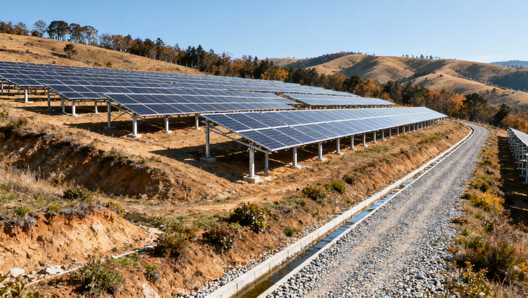
Consider a maintenance team supporting isolated solar assets. A drone carrying a small sensor module may avoid a long vehicle journey, but the value is not simply faster transport. The actual benefit may be reduced equipment downtime, fewer technician dispatches, and more predictable inventory support. That distinction affects the payload container, route frequency, delivery-point design, and business case.
Site selection determines whether last-mile delivery is truly operational
Launch and receiving sites are often treated as a facilities detail. In practice, they are among the strongest determinants of route reliability. A well-chosen site reduces flight complexity, protects people and property, supports repeatable loading, and gives operators a clear response path when conditions deteriorate.
The origin site: make dispatch repeatable
The launch location needs more than an open patch of ground. It requires a controlled workflow: package staging, identification checks, battery or charging arrangements, maintenance access, secure storage, and a clear separation between staff activity and aircraft movement. If the operation involves sensitive items such as diagnostic samples, medical products, or high-value electronics, chain-of-custody controls should be designed into the dispatch area rather than added later.
Assess overhead obstacles, nearby cranes, power lines, reflective surfaces, vehicle circulation, and potential sources of radio-frequency interference. Also examine the practical rhythm of the site. A loading area that is quiet at 8 a.m. may be congested with forklifts and delivery vehicles by midday.
The destination site: the final 20 metres matter
At the receiving end, the most convenient location on a satellite image is not necessarily the safest or most usable one. Rooftops may have turbulent airflow, restricted structural loading, access-control complications, and limited space for personnel. Ground stations can be easier to manage but may face pedestrian exposure, dust, animals, unauthorized access, or flood risk.
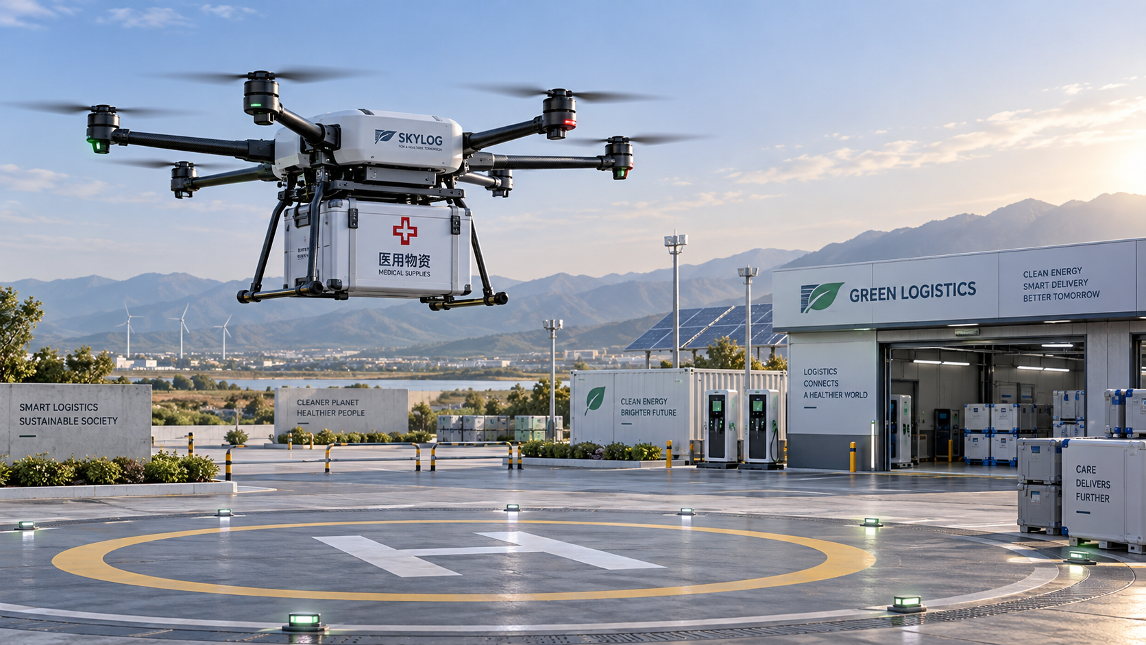
A destination assessment should cover approach and departure corridors, surface condition, obstacle clearance, emergency alternatives, lighting where relevant, and how the receiver retrieves the payload. For some operations, a landing pad is appropriate. For others, a controlled tether-lowering station or a secure drop enclosure may reduce the need for the aircraft to land. The correct choice depends on package fragility, site geometry, security needs, and local operating approvals.
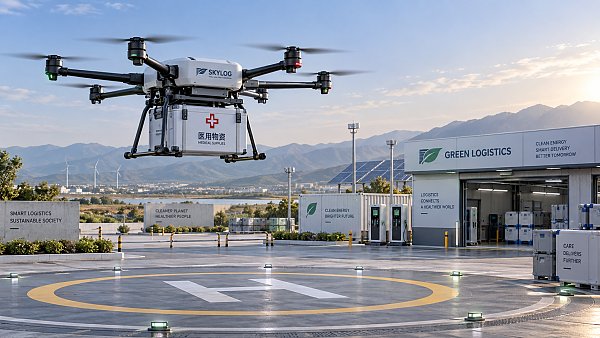
Site design should also anticipate the human moment at handover. Who is authorized to receive the item? How will they know it has arrived? What prevents a package from remaining outdoors in heat, rain, or public view? A technically successful flight still creates an operational failure if the recipient cannot safely collect the delivery.
Payload planning is a system exercise
Payload capacity is frequently misunderstood as a single maximum weight. For route planning, payload means the entire carried system: the item, protective packaging, thermal material, tracking device, restraint hardware, and any delivery mechanism. The shape and centre of gravity of that load can be as important as its mass.
Project teams should build a payload catalogue rather than rely on a generic “up to X kilograms” assumption. Group items by characteristics that affect flight and handling:
- Mass and dimensions: including the largest expected package, not only the average one.
- Fragility: whether vibration, tilt, shock, or a hard landing could compromise the contents.
- Environmental sensitivity: temperature bands, humidity exposure, dust protection, and sunlight tolerance.
- Hazard profile: batteries, chemicals, pressurized items, or regulated materials requiring additional controls.
- Security: tamper evidence, locked compartments, recipient verification, and tracking requirements.
This catalogue reveals an important truth: not every delivery belongs on the same aircraft or route. A lightweight urgent spare part may be ideal for aerial delivery, while a larger but less time-critical box may remain better suited to a van. Strong drone delivery solutions do not attempt to replace every last-mile vehicle movement. They identify the missions where aerial transport solves a real operational constraint.
Protect the payload without erasing the range advantage
Over-packaging is a common response to risk, especially in pilot programs. It can quietly undermine range, increase loading time, and reduce usable payload volume. The better approach is to test packaging against realistic handling events: take-off vibration, cruise movement, descent, delivery transfer, and recovery. For temperature-controlled shipments, validate the combined performance of insulation, cooling element, transit duration, waiting time at destination, and local weather exposure.
Packaging should be standardized wherever possible. A repeatable container reduces loading errors, supports faster inspection, and makes it easier to verify that the aircraft is operating within its approved weight-and-balance envelope.
Range is an operational envelope, not a marketing number
Range planning deserves more discipline than drawing a radius around a depot. The route must be evaluated as a complete energy budget. The aircraft needs enough energy to launch, climb, cruise, manoeuvre, hold if needed, deliver the payload, return or divert, and retain an appropriate reserve. Wind direction can be decisive: a favorable outbound leg may leave the aircraft facing a stronger headwind on return.
Instead of asking, “Can the drone travel 30 kilometres?” ask, “Can this aircraft complete this mission with this payload, in this season, under defined weather limits, while preserving the required reserve and contingency options?” That is the question operations teams can defend.
For longer corridors, a network model may be more resilient than a single long route. Intermediate hubs, approved recovery locations, or distributed inventory points can reduce exposure to weather and battery uncertainty. They also provide options when an urgent delivery must be rerouted after a site becomes unavailable.
Design the route around exceptions before scaling normal operations
A pilot can appear successful when every flight happens in fair weather, with trained staff waiting at both ends. Commercial readiness begins when the project team can explain what happens outside those ideal conditions.
Build decision rules for wind increases, loss of communications, destination access issues, unexpected obstacles, degraded battery health, rejected handovers, and aircraft faults. Define who can pause operations, who approves a return or diversion, and how customers or internal users are notified. These details may feel administrative during initial planning, yet they often determine whether stakeholders trust the service.
Route risk assessment should include the ground environment as well as the air route. Flying over sparsely populated industrial land may create a different risk profile from crossing roads, warehouses, rail lines, schools, or dense residential areas. Local aviation rules, airspace restrictions, privacy considerations, and permissions vary widely by jurisdiction. Engage the relevant aviation authority and site stakeholders early, especially where operations may extend beyond visual line of sight or involve automated delivery workflows.
Integrate drone delivery into the logistics workflow
The aircraft is only one node in the supply chain. A route becomes commercially useful when it connects to inventory systems, dispatch priorities, warehouse processes, receiving teams, and proof-of-delivery records. Without that integration, a drone may deliver an item quickly while the organization still loses time searching for stock, approving release, or confirming receipt.
For project managers, the most valuable integration questions are often simple: What event triggers a dispatch? Which system confirms that the item is available? How is the shipment identified? Where is delivery status visible? Can the recipient report a damaged or missing package immediately? How are failed missions reconciled with inventory records?
Supply chain software, telemetry platforms, and digital chain-of-custody tools can make these workflows visible, but they should support a clear operating process rather than mask an unclear one. Data governance also matters. Flight records, location data, maintenance history, and recipient information may carry security or privacy implications that need defined ownership and retention policies.
A practical route-planning sequence for engineering teams
Rather than launching a broad pilot with loosely defined goals, start with one delivery lane that has a clear operational pain point. Map the current process from request to receipt, including vehicle travel time, waiting time, access constraints, and the cost of delay. Then identify the payload classes that are genuinely suitable for aerial transport.
Next, survey origin and destination sites in person. Desktop mapping is useful, but it cannot fully reveal airflow, construction activity, access behavior, signal quality, or the informal routines that shape a site. Develop a preliminary route and energy model, then test it with representative loads and conservative weather assumptions.
Only after the physical route is understood should the team finalize procedures, training, maintenance planning, integration requirements, and performance measures. Track more than flight time: successful handovers, aborted missions, package condition, dispatch-to-receipt time, operator workload, and exceptions resolved without service disruption are often more meaningful indicators.
Choosing a solution partner with decision-grade evidence
When evaluating providers of drone delivery solutions, project leaders should look beyond aircraft specifications and demonstration footage. Ask for clarity on operational assumptions, maintenance responsibilities, data interfaces, payload validation, training needs, route-authorisation support, and the limits of the proposed system. A credible partner will discuss constraints openly, including weather boundaries, site dependencies, and the work required before scale.
For organizations assessing technologies across borders, reliable market intelligence is equally important. Platforms such as TradeNexus Pro help decision-makers examine supply-chain technologies in context: not only what a system claims to do, but where it fits within operational workflows, procurement risk, digital infrastructure, and evolving industry demand. This is particularly relevant when drone logistics intersects with healthcare technology, advanced manufacturing, green-energy assets, or supply chain SaaS.
The route is the product
Successful drone delivery is rarely defined by a dramatic first flight. It is defined by a route that can be operated calmly, repeatedly, and safely when people are busy and conditions are imperfect. The strongest programs treat the launch site, package, aircraft, destination, software, and response procedure as one connected design.
For engineering leaders, that perspective turns an interesting aviation project into a workable last-mile capability. Plan the sites with care, classify payloads honestly, calculate range conservatively, and make exception handling part of the design from day one. Those choices create the foundation for drone delivery routes that are not merely possible, but useful.
Get weekly intelligence in your inbox.
No noise. No sponsored content. Pure intelligence.
 Sep 20, 2026Microgrid Controller Pricing: What Drives Cost in Commercial Energy Projects?Microgrid Controller Pricing: What Drives Cost in Commercial Energy Projects?
 Sep 19, 2026How to Choose a GaN Charger for Laptops Without Compromising Power or PortabilityHow to Choose a GaN Charger for Laptops Without Compromising Power or Portability
 Sep 18, 2026Floating Solar Farm Costs: CAPEX, OPEX, and the Site Factors That Shape ROIFloating Solar Farm Costs: CAPEX, OPEX, and the Site Factors That Shape ROI
 Sep 17, 2026Drone Delivery Solutions for Last-Mile Routes: Site, Payload, and Range PlanningDrone Delivery Solutions for Last-Mile Routes: Site, Payload, and Range Planning
 Sep 16, 2026When Low-Volume Electronics Manufacturing Makes More Sense Than Mass ProductionWhen Low-Volume Electronics Manufacturing Makes More Sense Than Mass Production
 Sep 15, 2026Wholesale WiFi Smart Switches: What Buyers Should Verify Before OrderingWholesale WiFi Smart Switches: What Buyers Should Verify Before Ordering
 Sep 14, 2026How to Select IoT Sensors for Reliable Monitoring in Harsh Industrial EnvironmentsHow to Select IoT Sensors for Reliable Monitoring in Harsh Industrial Environments
 Sep 13, 2026How Procurement Teams Can Improve Supplier Reliability With Supply Chain VisibilityHow Procurement Teams Can Improve Supplier Reliability With Supply Chain Visibility
 Sep 12, 2026Smart Manufacturing Trends 2026: What Leaders Should Prioritize for ROISmart Manufacturing Trends 2026: What Leaders Should Prioritize for ROI
 Sep 11, 2026B2B Market Analysis: How Buyers Evaluate Suppliers, Pricing, and Delivery RiskB2B Market Analysis: How Buyers Evaluate Suppliers, Pricing, and Delivery Risk
 Sep 10, 2026Residential Solar Kits in Canada: How to Size a System for Your Home and ClimateResidential Solar Kits in Canada: How to Size a System for Your Home and Climate
 Sep 09, 2026How to Specify a Syringe Assembly Line for High-Volume Sterile ProductionHow to Specify a Syringe Assembly Line for High-Volume Sterile Production
 Sep 08, 2026How to Evaluate Warehouse Robotics System Suppliers for Reliable Multi-Site DeploymentHow to Evaluate Warehouse Robotics System Suppliers for Reliable Multi-Site Deployment
 Sep 07, 2026Renewable Geothermal Energy Explained: How It Works for Heating and PowerRenewable Geothermal Energy Explained: How It Works for Heating and Power
 Sep 07, 2026How to Choose an Industrial Packaging Robot Manufacturer for Your Production LineHow to Choose an Industrial Packaging Robot Manufacturer for Your Production Line
 Sep 05, 2026How to Evaluate a Turnkey Hydro Turbine Generator Supplier for Remote Power ProjectsHow to Evaluate a Turnkey Hydro Turbine Generator Supplier for Remote Power Projects
 Sep 04, 2026Automated Ultrasonic Welding for Thermoplastic Assemblies: Process Controls That MatterAutomated Ultrasonic Welding for Thermoplastic Assemblies: Process Controls That Matter
 Sep 03, 2026Energy Forecasting for Grid Planning: Sizing Solar and Storage CapacityEnergy Forecasting for Grid Planning: Sizing Solar and Storage Capacity
 Sep 02, 2026Which Metrics Should an Energy Analytics Dashboard Track for Factory Energy Management?Which Metrics Should an Energy Analytics Dashboard Track for Factory Energy Management?
 Sep 01, 2026How Warehouse Voice Picking Improves Accuracy and Throughput in Order FulfillmentHow Warehouse Voice Picking Improves Accuracy and Throughput in Order Fulfillment
 Aug 31, 2026How to Automate Dropshipping Order Processing Without Overselling StockHow to Automate Dropshipping Order Processing Without Overselling Stock
 Aug 30, 2026How to Evaluate a Smart Lighting Supplier for Multi-Site Commercial ProjectsHow to Evaluate a Smart Lighting Supplier for Multi-Site Commercial Projects
 Aug 29, 2026Recent Advances in Smart Manufacturing and Materials Reshaping Factory InvestmentRecent Advances in Smart Manufacturing and Materials Reshaping Factory Investment
 Aug 29, 2026Selecting Lightweight Aluminum Extrusions for Strength-Critical Industrial DesignsSelecting Lightweight Aluminum Extrusions for Strength-Critical Industrial Designs
 Aug 29, 2026Vertical Powder Anodizing Explained: Process Controls for Uniform Coating QualityVertical Powder Anodizing Explained: Process Controls for Uniform Coating Quality
 Aug 29, 2026PV Module Product Due Diligence: What Buyers Should Verify Before ContractingPV Module Product Due Diligence: What Buyers Should Verify Before Contracting
 Aug 29, 2026Solar Design for Challenging Terrain: Managing Slope, Soil, and Shading RisksSolar Design for Challenging Terrain: Managing Slope, Soil, and Shading Risks